|
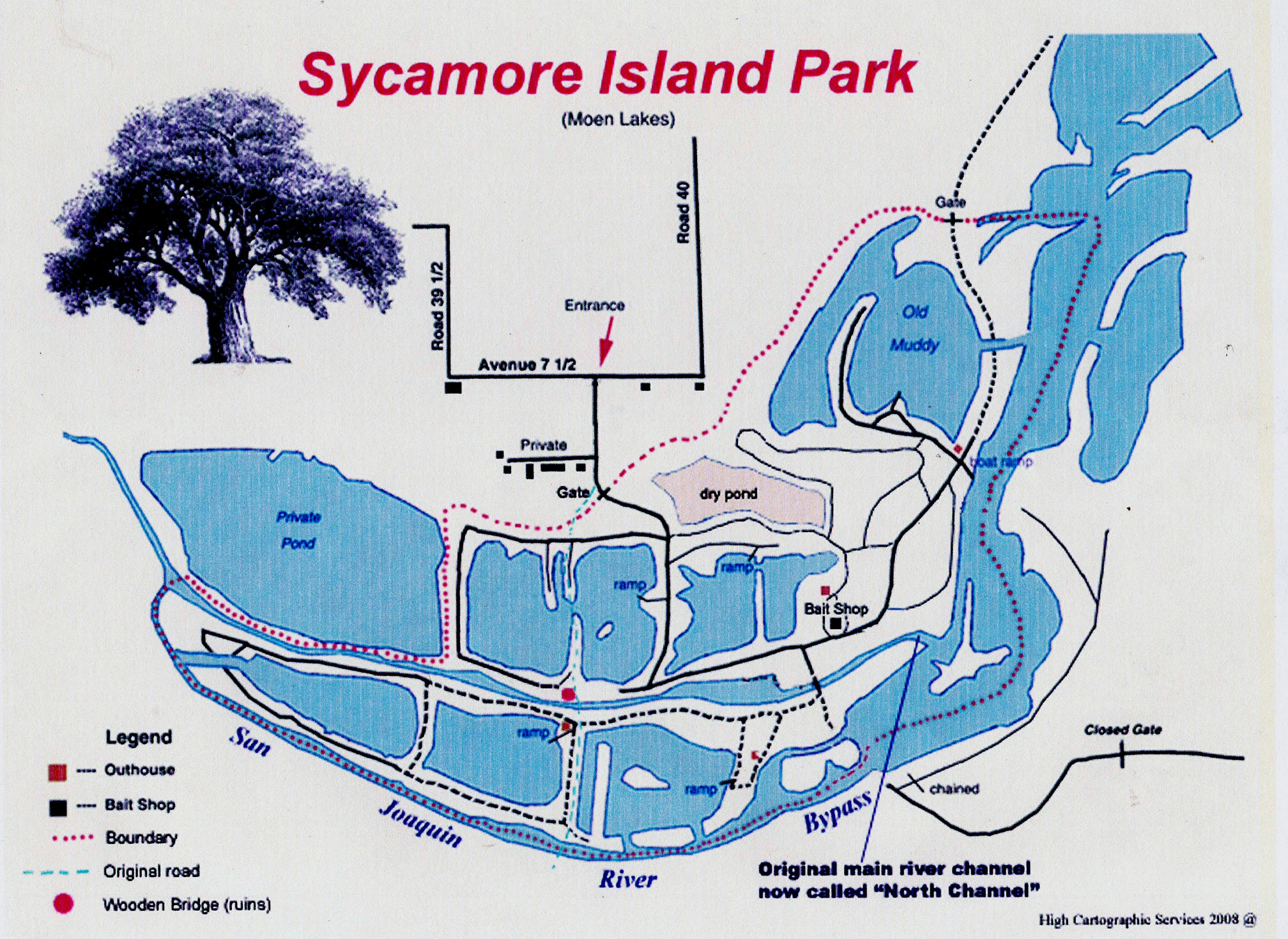
From Fresno: North on Hwy41, WEST on Childrens Blvd (this wraps around Valley Childrens Hospital and becomes
Avenue 9) about 2 miles, south on Rd40 about 2 miles till it ends, west on Avenue 7 1/2 about 400 yards. Watch for the
sign on your left in the gated field. Follow the gravel road down to the smaller of 2 buildings (Park HQ and the Bait
Shop) This is where you pay and sign in.
From Madera/Merced: From Hwy99, east on Avenue9 about 8 miles, South on Rd40, rest same as above.

The above map was made from an aerial photo taken in 2004 and colorized through Adobe Photoshop. Note that the
current dried up waterway now known as the "North Channel" was the original course of the river. The gravel company
diverted water away from it to facilitate operations. Today, the "southern diversion" is considered the main course
of the river. The North Channel is considered by some to be "man-made" , however, historically this is not so.
After the large release of water from Friant Dam in 2005, the river deepened its course along the southern bluff, leaving
the channel high and dry. It would take nearly a 2 foot rise in water level for water to begin flowing through it again.....or
a rock weir near the confluence to create a higher level. It was the water in the North Channel that largely fed the
ponds to the north. Another option to restore water to the drying ponds would be to dig a ditch to river level to connect
the corner of the Old Muddy into the first dry pond. This would feed water into the ponds without detracting from the
current "south channel" and would not be dependant upon high water releases to maintain viability.
  |


